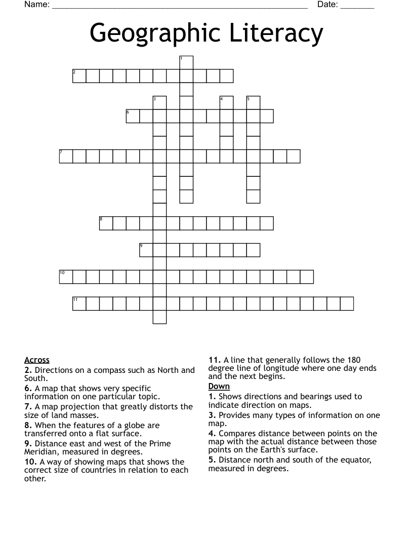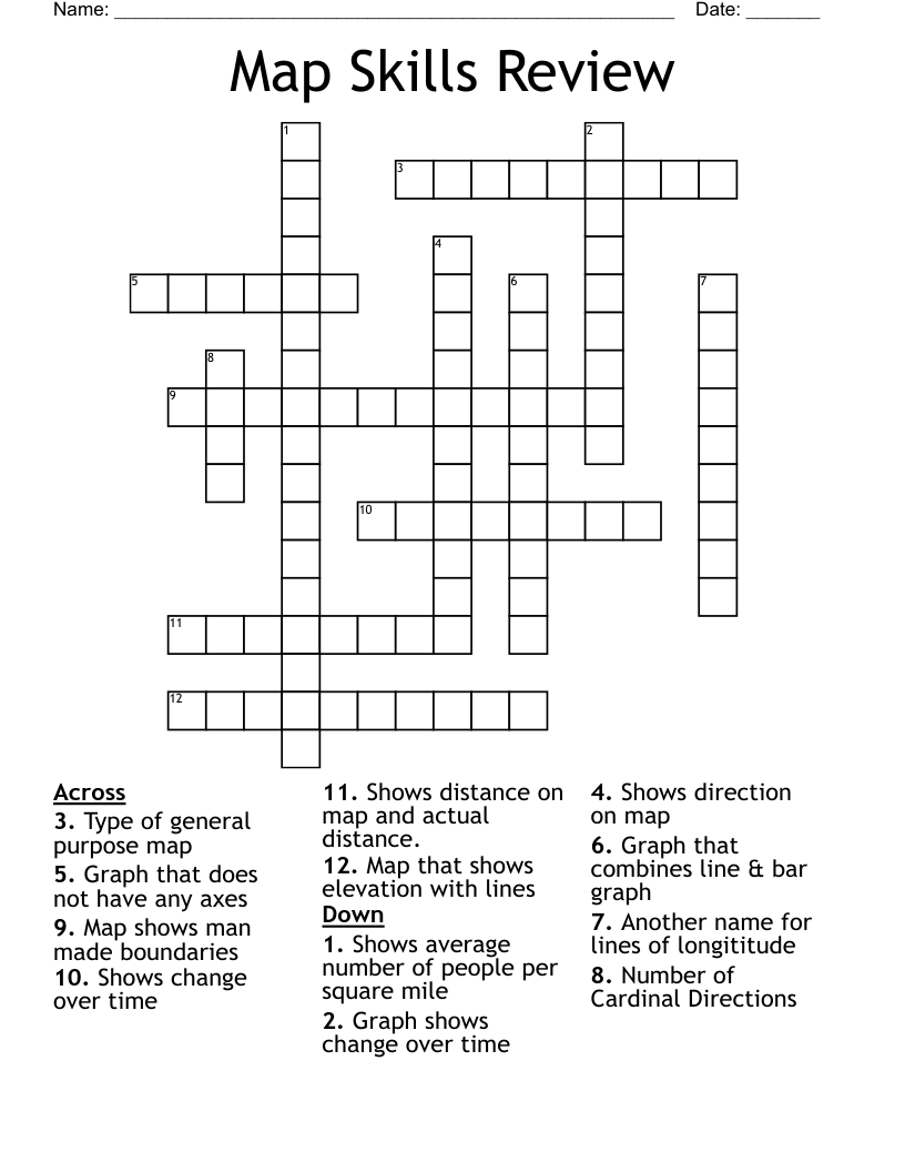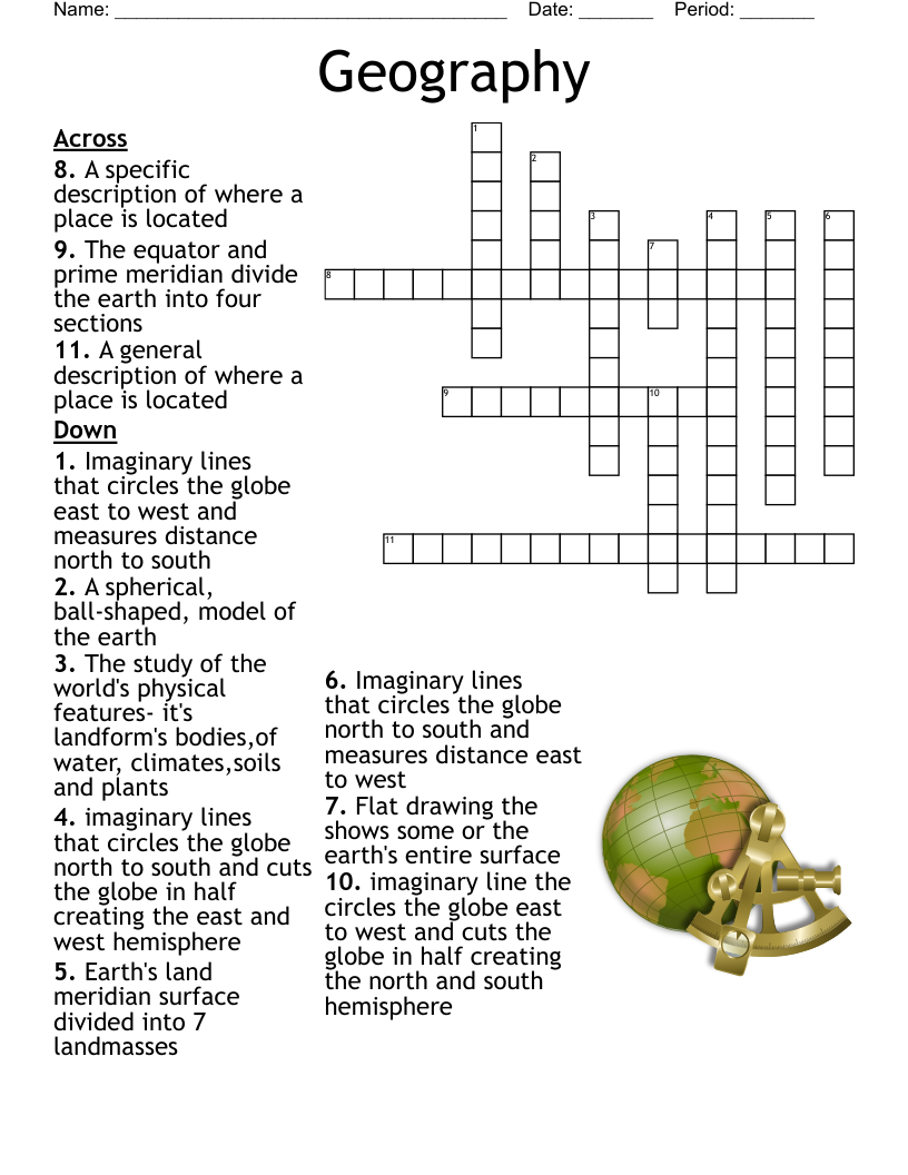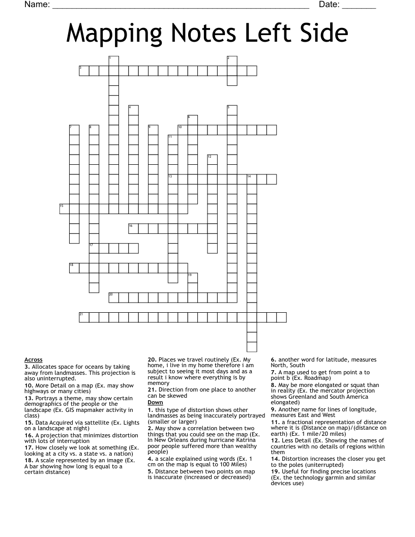
Mapping Notes Left Side Crossword
This printable crossword puzzle on the topic of Physical Geography has 21 clues. Answers range from 3 to 21 letters long. This crossword is also available to download as a Microsoft Word document or a PDF.
Description
A map used to get from point a to point b (Ex. Roadmap)
Portrays a theme, may show certain demographics of the people or the landscape (Ex. GIS mapmaker activity in class)
Places we travel routinely (Ex. My home, i live in my home therefore i am subject to seeing it most days and as a result i know where everything is by memory
May show a correlation between two things that you could see on the map (Ex. In New Orleans during hurricane Katrina poor people suffered more than wealthy people)
Data Acquired via sattellite (Ex. Lights on a landscape at night)
Useful for finding precise locations (Ex. the technology garmin and similar devices use)
How closely we look at something (Ex. looking at a city vs. a state vs. a nation)
More Detail on a map (Ex. may show highways or many cities)
Less Detail (Ex. Showing the names of countries with no details of regions within them
a scale explained using words (Ex. 1 cm on the map is equal to 100 Miles)
A scale represented by an image (Ex. A bar showing how long is equal to a certain distance)
a fractional representation of distance where it is (Distance on map)/(distance on earth) (Ex. 1 mile/20 miles)
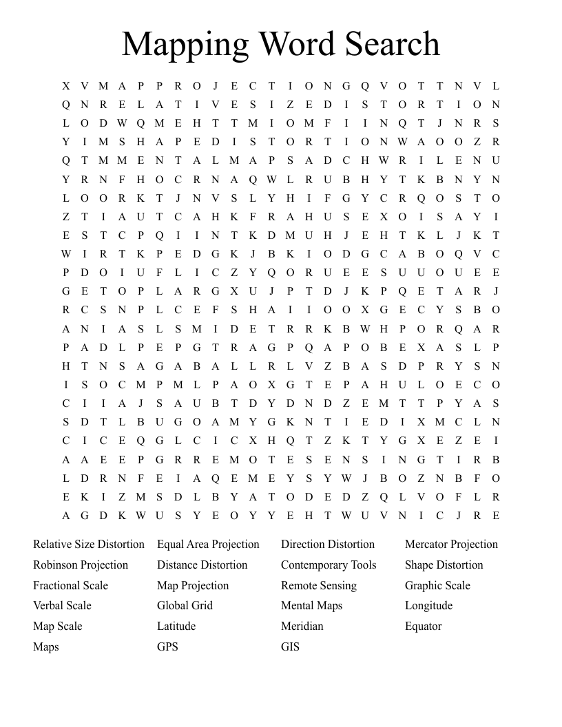
Another name for lines of longitude, measures East and West
another word for latitude, measures North, South
this type of distortion shows other landmasses as being inaccurately portrayed (smaller or larger)
May be more elongated or squat than in reality (Ex. the mercator projection shows Greenland and South America elongated)
Distance between two points on map is inaccurate (increased or decreased)
Direction from one place to another can be skewed
A projection that minimizes distortion with lots of interruption
Allocates space for oceans by taking away from landmasses. This projection is also uninterrupted.
Distortion increases the closer you get to the poles (uniterrupted)