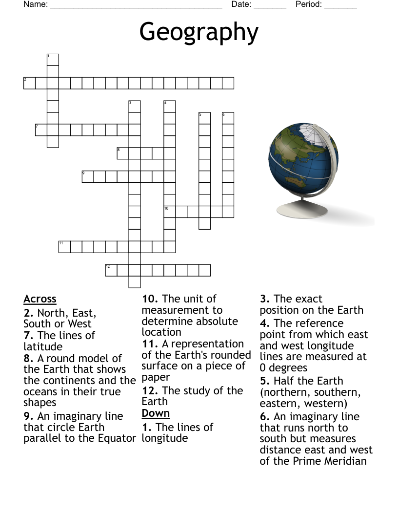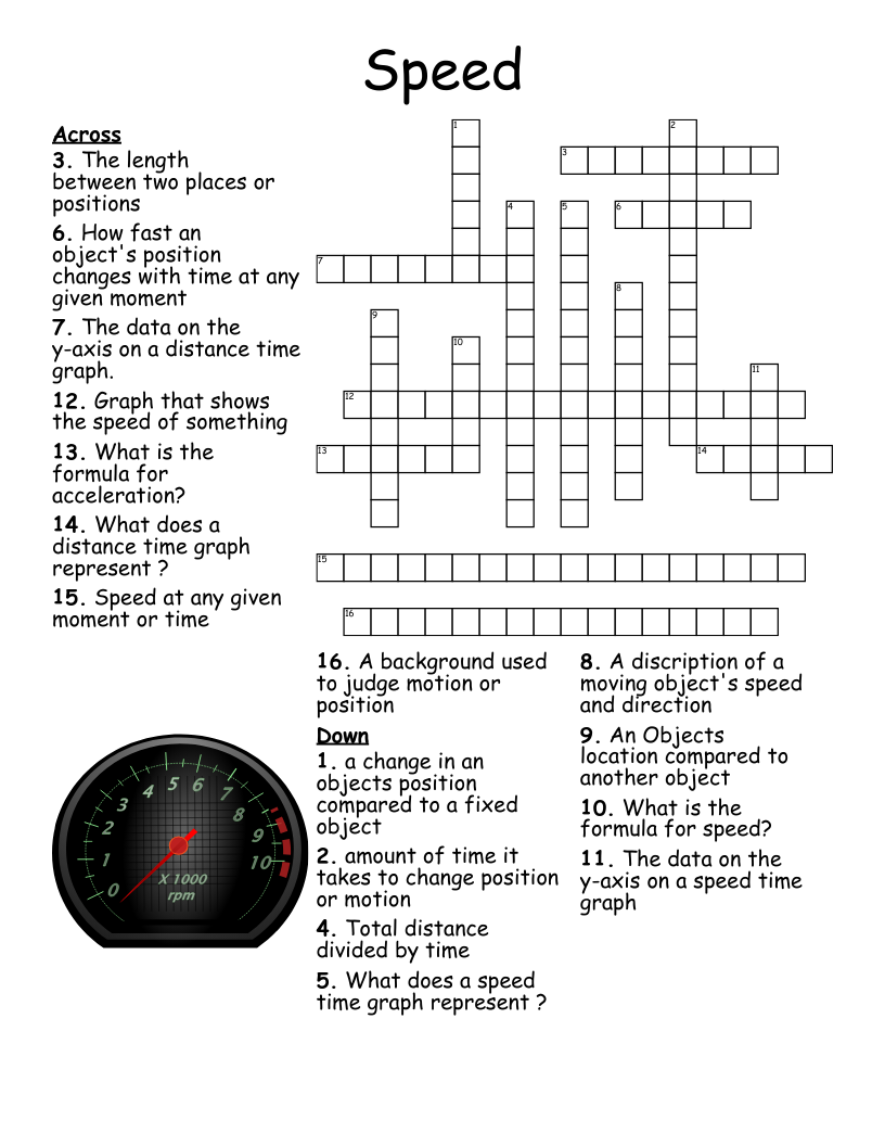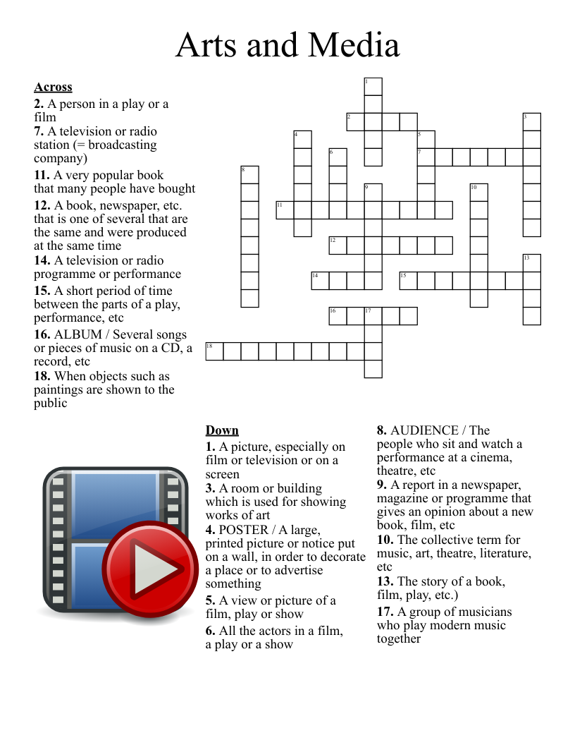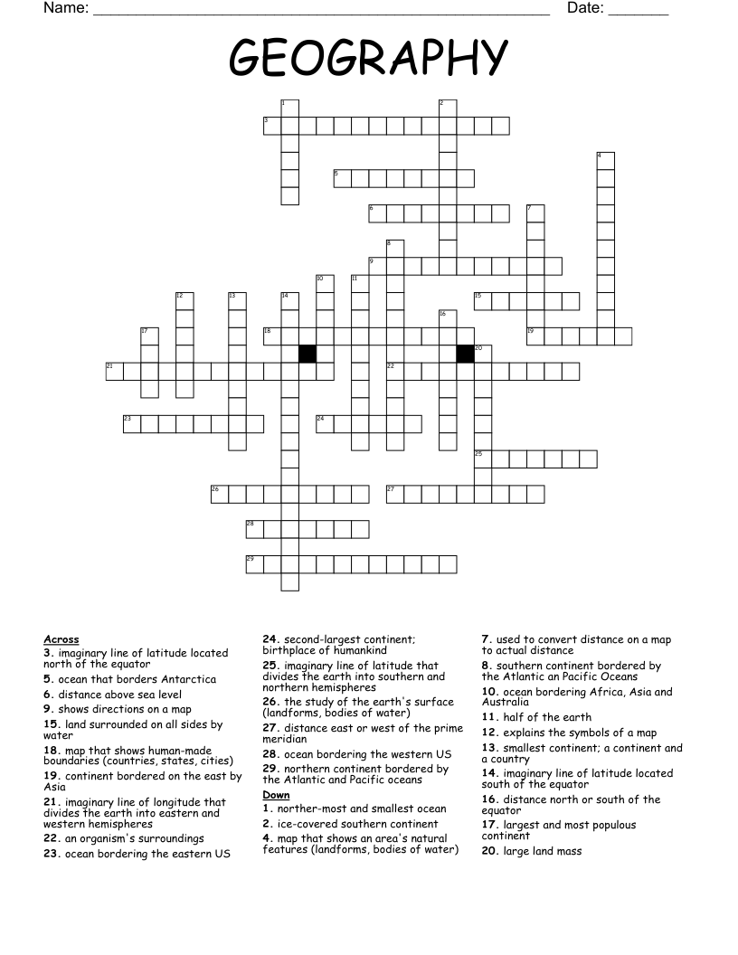
Crossword for Map Skills
This printable crossword puzzle on the topic of Physical Geography has 15 clues. Answers range from 3 to 18 letters long. This crossword is also available to download as a Microsoft Word document or a PDF.
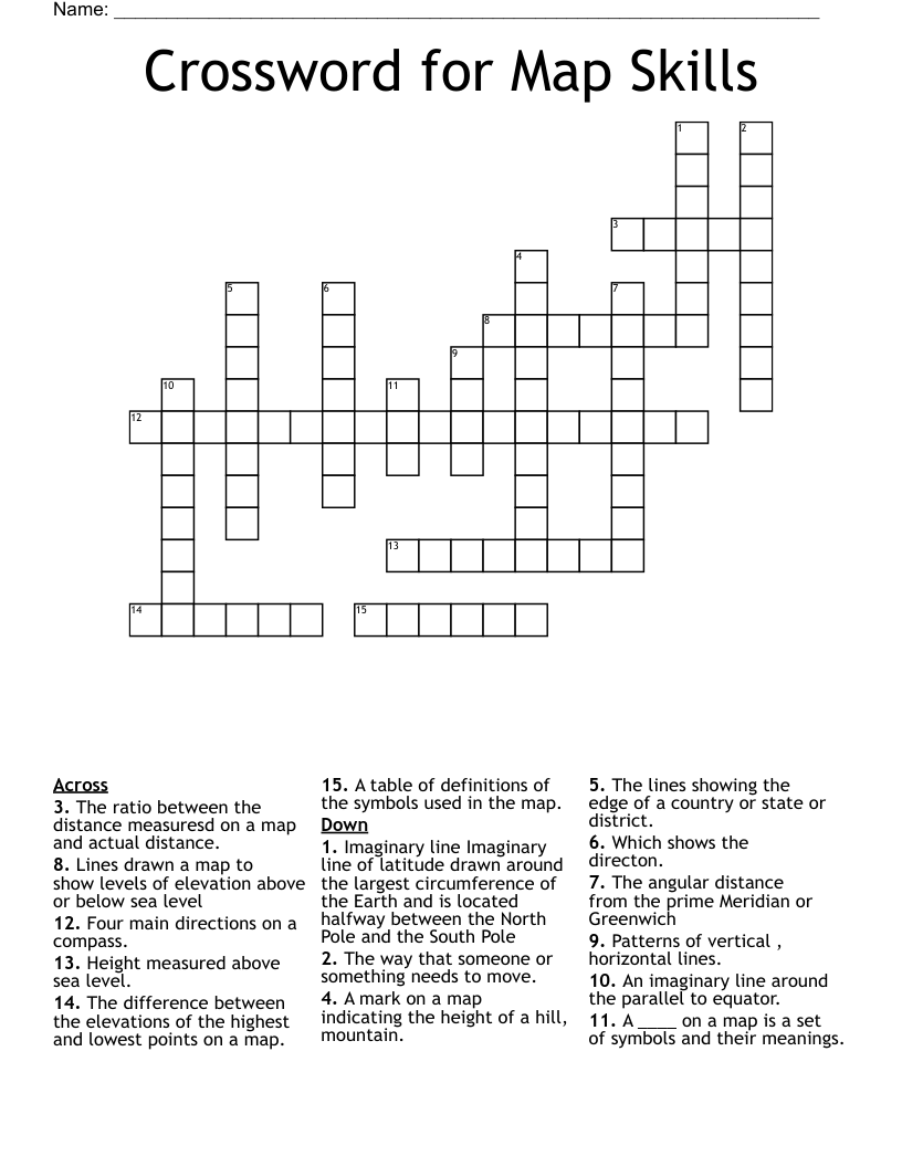
Description
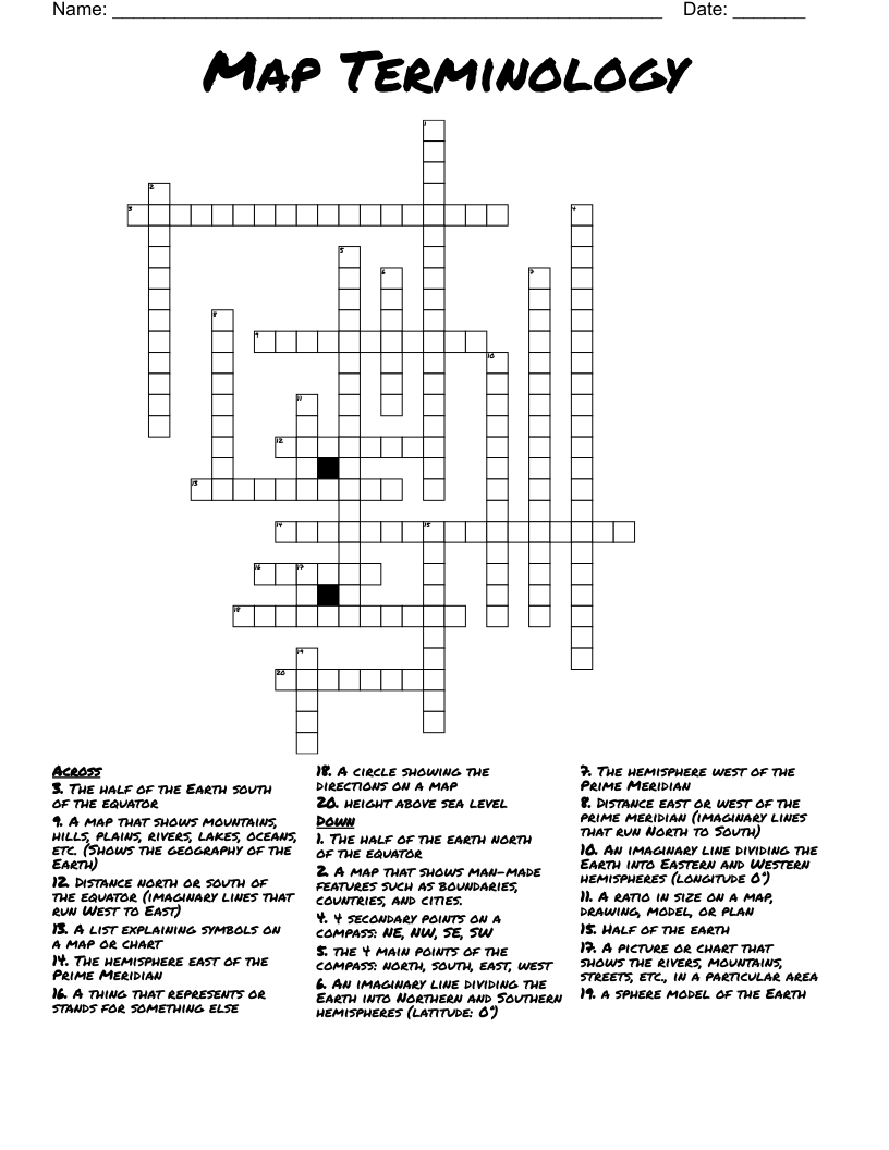
The lines showing the edge of a country or state or district.
A ____ on a map is a set of symbols and their meanings.
Patterns of vertical , horizontal lines.
The ratio between the distance measuresd on a map and actual distance.
An imaginary line around the parallel to equator.
The angular distance from the prime Meridian or Greenwich
Which shows the directon.
Lines drawn a map to show levels of elevation above or below sea level
A table of definitions of the symbols used in the map.
The way that someone or something needs to move.
The difference between the elevations of the highest and lowest points on a map.
Height measured above sea level.
A mark on a map indicating the height of a hill, mountain.
Four main directions on a compass.
Imaginary line Imaginary line of latitude drawn around the largest circumference of the Earth and is located halfway between the North Pole and the South Pole