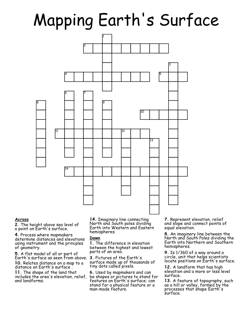
Mapping Earth's Surface Crossword
This printable crossword puzzle on the topic of Physical Geography has 14 clues. Answers range from 3 to 15 letters long. This crossword is also available to download as a Microsoft Word document or a PDF.
Description
The shape of the land that includes the area's elevation, relief, and landforms.
The height above sea level of a point on Earth's surface.
The difference in elevation between the highest and lowest parts of an area.
A flat model of all or part of Earth's surface as seen from above.
Relates distance on a map to a distance on Earth's surface .
Used by mapmakers and can be shapes or pictures to stand for features on Earth's surface; can stand for a physical feature or a man-made feature.
Is 1/360 of a way around a circle, unit that helps scientists locate positions on Earth's surface.
An imaginary line between the North and South Poles dividing the Earth into Northern and Southern hemispheres.
Imaginary line connecting North and South poles dividing Earth into Western and Eastern hemispheres.
Process where mapmakers determine distances and elevations using instrument and the princples of geometry.
Represent elevation, relief and slope and connect points of equal elevation.
Pictures of the Earth's surface made up of thousands of tiny dots called pixels.
A feature of topography, such as a hill or valley, formed by the processes that shape Earth's surface.
A landform that has high elevation and a more or less level surface.