Geo Worksheet
This printable matching worksheet on the topic of Physical Geography has 18 questions and answers to match. This matching worksheet is also available to download as a Microsoft Word document or a PDF.
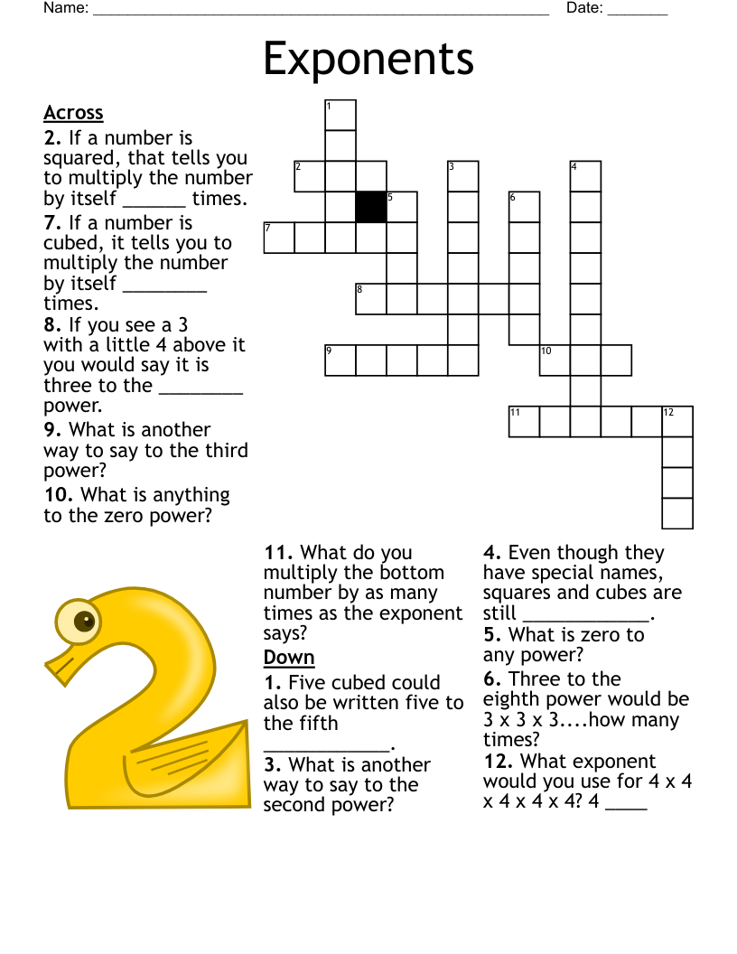
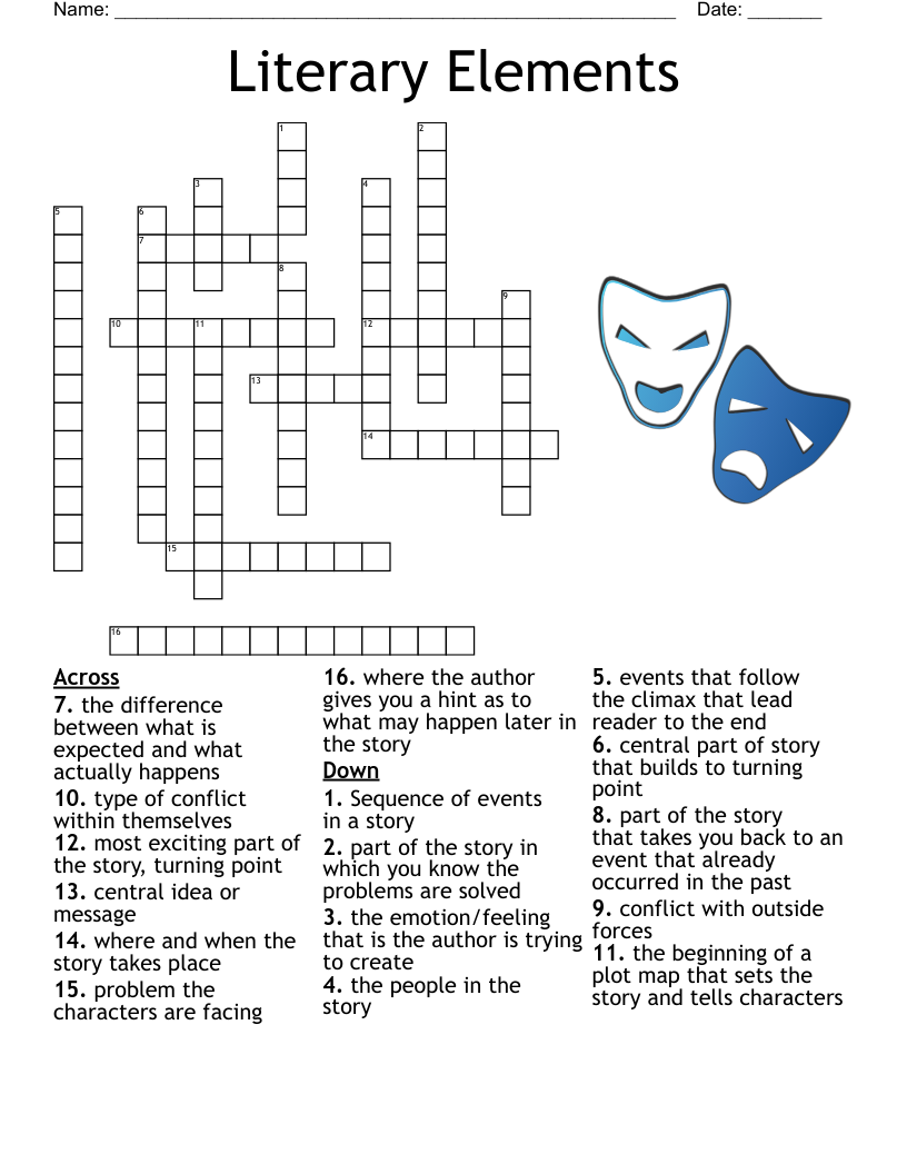
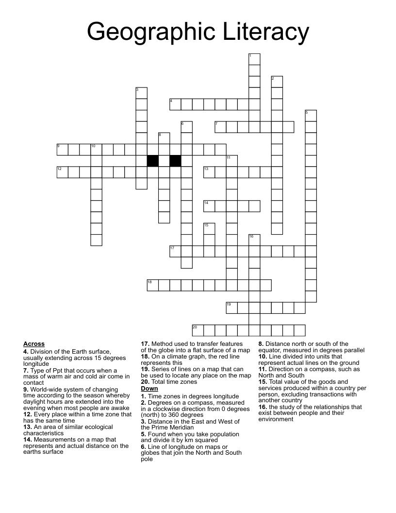
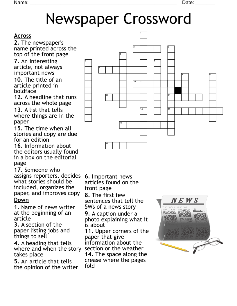
Description
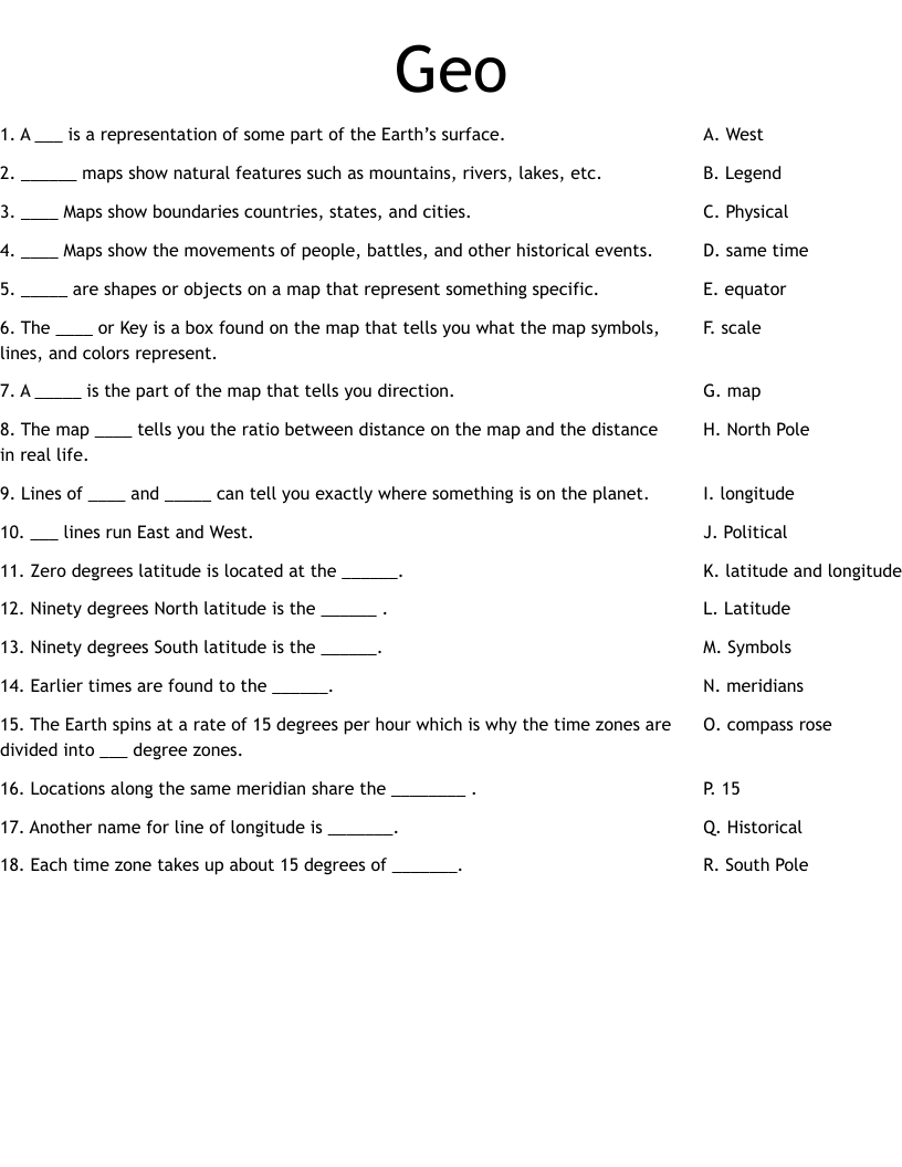
A ___ is a representation of some part of the Earth’s surface.
______ maps show natural features such as mountains, rivers, lakes, etc.
____ Maps show boundaries countries, states, and cities.
____ Maps show the movements of people, battles, and other historical events.
_____ are shapes or objects on a map that represent something specific.
The ____ or Key is a box found on the map that tells you what the map symbols, lines, and colors represent.
A _____ is the part of the map that tells you direction.
The map ____ tells you the ratio between distance on the map and the distance in real life.
Lines of ____ and _____ can tell you exactly where something is on the planet.
___ lines run East and West.
Zero degrees latitude is located at the ______.
Ninety degrees North latitude is the ______ .
Ninety degrees South latitude is the ______.
Earlier times are found to the ______.
The Earth spins at a rate of 15 degrees per hour which is why the time zones are divided into ___ degree zones.
Locations along the same meridian share the ________ .
Another name for line of longitude is _______.
Each time zone takes up about 15 degrees of _______.